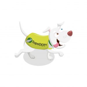
Find Piggle Wiggle, the TopoDOT dog. What has she found?
Piggle Wiggle has spotted the Topcon vehicle, which is carrying a laser scanner (also called LiDAR, an acronym for Light Detection and Ranging). This scanner sitting on the vehicle is called a Mobile Mapping System: it’s ‘mobile’ because it can be attached to any type of vehicle like a car or a boat, and it’s a ‘mapping system’ because it collects what we call ‘geospatial’ data. This data lets us quickly create very accurate maps of things on or above the surface of the earth. People called surveyors need these maps to help them plan things like roads and pipelines. For example, the maps can help them work out how much aggregate they’ll need to lay a road, or whether parts of a road are broken.
LiDAR works by shooting out laser beams and then seeing how long it takes for the beams to bounce back: things which are further away take longer to bounce the beams back. LiDAR can use millions of bounce-back times (or ‘data points’) to create a map which shows exactly what’s happening on the surface. Here, the Topcon vehicle is measuring the road surface (and things like potholes) as well as trees and buildings. Before LiDAR, people had to do these measurements manually, by walking on the road, which was very slow and could be dangerous. For further information about Topcon’s Mobile Mapping system called IP S3 click here
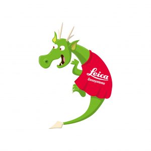
Find Draco the dragon. What has he spotted?
Draco has found a boat on the River Thames, and he wonders what it’s doing. The man on the boat is actually a surveyor working as a ‘hydrographer’, someone who takes measurements to help describe the physical features of oceans, seas, lakes and rivers. The hydrographer tells Draco, “We’re using this laser scanner, which takes measurements and pictures of the River Thames above the water. This lets us visualise the river in 3D, like a movie or video game. Then we can understand if the river bed, its sides and the land are moving. And because the river eventually empties out into the sea, we can understand what we have to do to protect the coastline from what’s happening on the river. We can also use sonar underwater radar to check the river bed, so we can make a full picture of the entire River Thames.
”
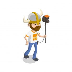
There is a viking inside the building. What’s he doing?
The Viking is using a handheld laser scanner to measure and record the inside of the building. His scanner collects thousands of measurements every second, which builds a 3D model of the rooms inside in real time! This 3D data helps architects, builders and engineers to work out where to install new building elements, to plan for building redevelopments or even where to fit new furniture!
Check out this video showing the scanner in action on a real building site!!
Can you find the yellow ground-penetrating radar? What do you think it does?
Remember we said that LiDAR is ‘geospatial’? Well, radar is a ‘geophysical’ method. It does the same sort of thing as LiDAR, but this particular system it measures things under the surface of the earth, instead and is known as Ground Penetrating Radar. It works the same way, but it uses pulses of radar instead of pulses of light, because light can’t go through the ground. Here, the engineer surveying the path is looking for pipes under the pavement. This means we don’t have to dig up the pavement just to have a look, which saves a lot of money, a lot of time, and a lot of bother for everyone.
What are the surveyors doing on the rail track?
These surveyors are using clever laser technology to survey the rail track. We need very accurate information about the ground that trains run on so that we can lay tracks safely and in exactly the right place. Once the tracks have been laid, we use the same technology to check on them regularly to see if they need repairing. This helps to save lives, because it means the trains can run safely without coming off the tracks.
Can you find the surveyor checking the height of the tree with her laser rangefinder?
This woman is a forester; she works with trees. Here, she’s using a laser rangefinder to measure the height of the tree from the ground. This is important when you want to cut trees down, so you can see how much space you need to clear when it falls, so that people and buildings don’t get hurt. It can also help us to check how well trees are growing, depending on how old they are.
Find Evan the Eagle. What has he spotted?

We’ve already seen how surveyors use LiDAR to measure things above the surface, and radar to measure things below the surface. But here, Evan has spotted something in the air: it’s an unmanned aerial vehicle (UAV), which is also called a ‘drone’. Drones can be very small or quite big, and they can carry all sorts of equipment. Surveyors and engineers can use them to measure the surface of the earth from the sky. They fit the drones with things like LiDAR scanners, or photogrammetry equipment (which can take measurements from photographs), or video cameras like GoPros. Doing measurements from the air can give us a different perspective, and help us measure areas that can’t easily be measured easily on foot or by vehicles – such as forests, steep mountainsides, or tall bridges and buildings. You have to be a qualified drone pilot to fly these systems. Find out more about Topcon’s aerial mapping using drones.
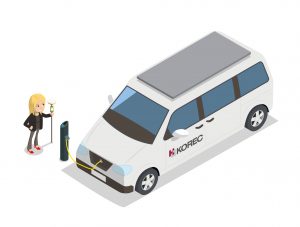
Find Helen and her ruby red shoes, what do you think she is doing?
People and businesses all over the world have important jobs of checking the position and condition of assets (an asset is something of value, so for you that could be your trampoline in your garden)
Helen’s job in this scene is to go and check the condition and record the position of all the drains in the street, these allow the water to escape after it rains so it does not flood.
Helen needs to know if any of the drains are blocked or need fixing.
This is a very busy road so Helen is cleverly using a phone app called Trimble Catalyst with KOREC K-Mobile software on her mobile phone. This uses an antenna that listens to signals sent by satellites high up in space. These signals give Helen an accurate position that the software plots onto a map. Helen can also record all the important information required, this information can be seen straight away by other members of her team back in an office, so if Helen finds any problems, someone can be sent out to fix it.
Using the Catalyst is like tracing a picture, only rather than drawing onto tracing paper, your picture is inside the computer and it allows you to draw much bigger areas like whole towns and cities.”
What is ‘Get Kids into Survey’?
This is a really important campaign to encourage children and young people to consider jobs in surveying. The industry hasn’t been effective enough at promoting surveying careers – and since schools don’t teach how maps are made or buildings are constructed, kids never get chance to find out about the geospatial industry. They are attracted by careers like gaming, but in fact there are lots of similarities! We need to get children and young people excited about the geospatial industry and all the amazing opportunities it offers.
Our partner in ‘Get Kids Into Survey’
We’ve joined forces with the National Society of Professional Surveyors (NSPS) in North America. They’ll promote #GetKidsintoSurvey throughout the USA and Canada, distributing our posters and other educational content. This will cut mailing costs and speed up delivery. With a circulation list of 24,000 surveyors across North America, they offer important benefits to the entire survey community.
The importance of education in Geospatial
Over 85% of UK surveyors said they have problems recruiting due to a lack of qualified applicants (RICS, 2015). In fact, “the skills shortage has now overtaken planning and regulation as the second biggest problem facing the industry” (Telegraph 2017). In the USA, POB Magazine reported a shortage of surveyors, full stop! The FIG and the NSPS both launched young surveyors networks to support surveyors aged up to 35 – but there’s a more basic challenge: to generate interest in surveying as a career while kids are still in school!
That’s why Elaine Ball Ltd has made it part of our mission to help raise the standards in the geospatial industry around the world by creating and delivering fun, interactive educational content for children and young people. We’re targeting Generation Z (born 1996-2010) and Gen Alpha (2011-2025) to help them learn how maps are made and how buildings are constructed. These disciplines are important for the future of building and sustaining and growing any construction workforce.